Details of record no: 75393
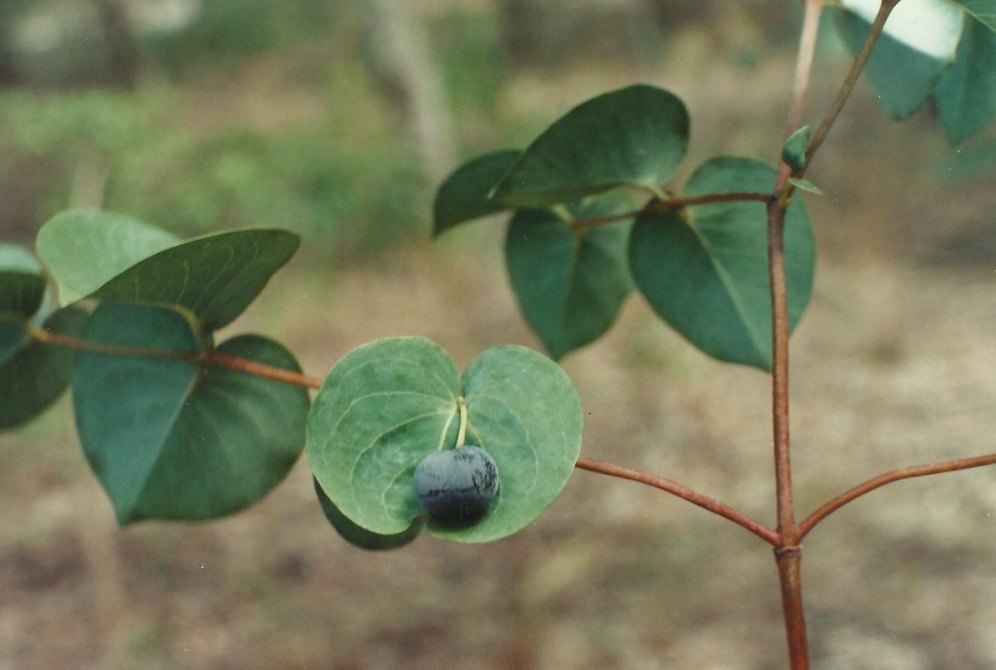
Rytigynia orbicularis
Three blocks of information are displayed on this page, namely: (a) details of the record; (b) the record point plotted using Google Maps and (c) any images attached to the record. Please scroll down to see the various items.
Record details:
| Date: | 18 Mar 1996 |
| Recorder(s): | DK Harder |
| Collector(s): | DK Harder 3727 |
| Determiner(s): | D Bridson |
| Confirmer(s): | |
| Herbarium: | K |
| Habitat: | Collection in local forest reserve Kalahari woodland. |
| Location: | Mongu District; Katoba local forest (#286) ca. 2.9 km east of intersection of Katoba access road and Mongu-Senanga Road. |
| Location code(s): | |
| Outing code: | |
| Planted code: | Not planted |
| Country: | Zambia |
| Quarter Degree Square: | 1523A4 (QDS approximate) |
| Grid reference: | |
| Altitude (metres): | 1030 |
| Notes: | Weak-wooded; shrub; leaves dull glaucous, green; branches light brown; fruit pedicel (positioned through leaf sinus); fruit light green to purple. |
| Latitude, Longitude: | -15.446667, 23.251944 |
| Location Accuracy Code: | 5 |
Map of species record
Images:
Image: 3

| Species id: | 202570 |
| Image id: | 3 |
| Image number: | 25647 |
| Photographer: | DK Harder | Code 1 if image of a herbarium specimen: | 0 |
| Herbarium in which image taken: | |
| Code 1 if image not to be displayed: | 0 |
| Image notes: | |